Ungap the Map: envisioning better bike networks
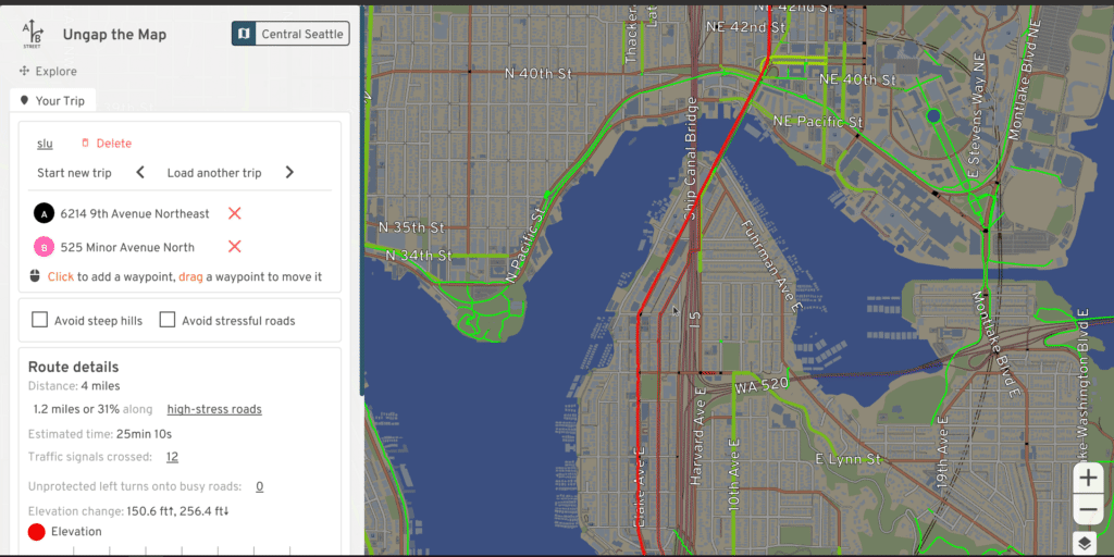
Ever want to visualize how your city would look if streets were designed to safely/comfortably make most trips by bike? This tool lets you quickly sketch out your own vision to fill in missing gaps in the network, see how the changes would impact your commute, and share the results with others.
- Web version
- To work for larger areas (like all of Seattle), it's highly recommend to
install the latest release
for Windows, Mac, or Linux. After unzipping, run
ungap_the_map.shorungap_the_map.bat. - See an example vision for Seattle
- 15-minute video overview
- This page: bike.abstreet.org
Credits
This project was inspired by conversations with members of Seattle Neighborhood Greenways, who had feedback about the main A/B Street traffic simulation being too open-ended. This was developed during August-October 2021 for the Taiwan presidential hackathon. This tool is part of A/B Street, which has had many contributors, but specifically for this tool:
- Dustin Carlino: primary creator
- Michael Kirk: usability feedback and fixes, ideas for what the tool should do, implemented road labels and large parts of the lane editor
- Mara Cruz: part-time UX help, connections to NYC's advocacy group
- Robin Lovelace: domain knowledge about mode shift
- Yuwen Li: A/B Street's main UX designer. Not directly involved in this tool, but the design is largely adapted from her prior work
- the Aurora Reimagined Coalition for letting us bring a prototype to a design workshop event
- contributors from the National Day of Civic Hacking
- Eldan Goldenberg: prior work on elevation data
- the OpenStreetMap community
- Angelina and Amanda, DemocracyLab volunteers, for participating in usability studies
- the organizers of the Taiwan hackathon for providing motivation and direction for the project