A/B Street
Overview
A/B Street is a traffic simulation game exploring how small changes to roads affect cyclists, transit users, pedestrians, and drivers. In other words, you can transform that street parking into a bus lane or fix that pesky left turn at a traffic signal, measure the effects, then propose actually making the change.
A/B Street uses game-like elements to gradually introduce all of the features of the simulation, with a tutorial and a few challenge modes. But just becaused it's called a "game" doesn't mean it's not trying to model the real world as accurately as possible from open data. (Keep in mind it's impossible to simulate all complexity in the real world of people moving around a city. Every traffic model makes lots of assumptions and trade-offs, including A/B Street.)
Explore
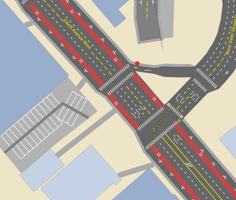
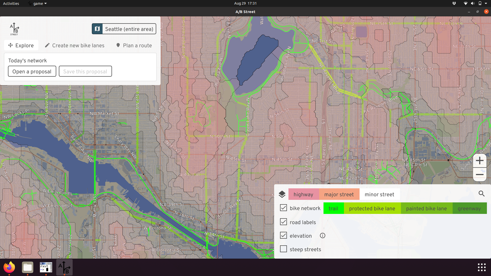
A/B Street gives you a 2D representation of roads, with as much detail about bus/bike/turn/parking lanes, transit stops, traffic signals, and parking lots as possible, all from OpenStreetMap.
Depending on elevation data availability, some areas let you visualize steep streets -- because your bike network should be planned accordingly.
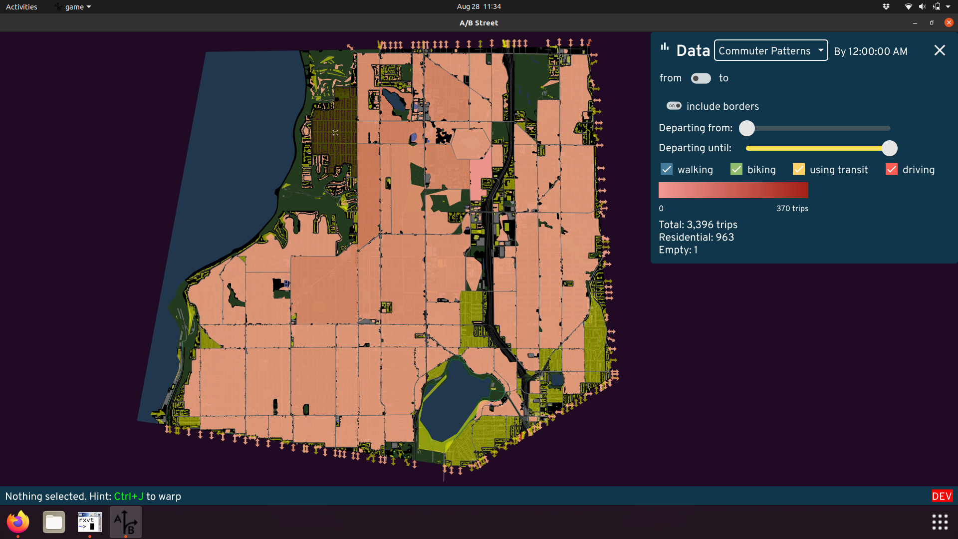
Using external travel demand models, you can explore patterns of where people live, work, and shop.
Simulate
Using some external data about what trips people take on a typical day, you can simulate drivers, bicyclists, and pedestrians moving around. (Public transit and scooter/bikeshare micromobility planned.)
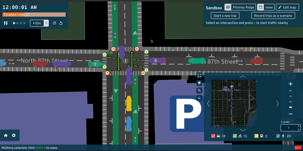
You can follow individual people and watch them wrestle with problems, or get a bird's-eye view of how everything is moving.
Every driving trip begins and ends with parking, which might be easy in suburban areas, but hard in cities.
Some details:
- People will take the best route available, not accounting for current congestion. Drivers prefer the fastest route (shorter distances, higher speed limits). Pedestrians and cyclists also factor in elevation changes.
- Vehicles instantly accelerate and stop. This is a useful simplification to speed up the simulation, but of course, you shouldn't use A/B Street to simulate jam waves on freeways.
- Vehicles stay in the same lane once they pick it, and sometimes they choose their lane really poorly. We're working on improving this.
- We don't simulate accidents -- but we do measure "risk exposure" where a collision may be likely.
Edit
A/B Street lets you change how road space is divided up. You can create regular vehicle lanes, bus-only lanes, bike lanes, street parking, and new sidewalks. You can either transform existing lanes, or slightly widen/shrink the road. You can reverse the direction of lanes, or close them down to simulate construction.
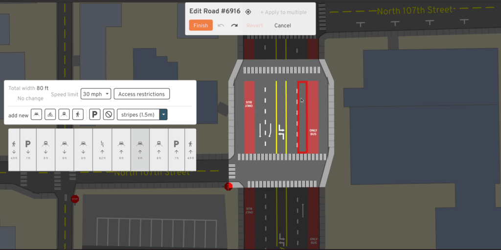
You can also change speed limits and restrict access to an area. Only trips that start or end in a private area can use the roads within, modelling gated communities. Or you can allow through-traffic for people walking and biking, to create low-traffic neighborhoods.
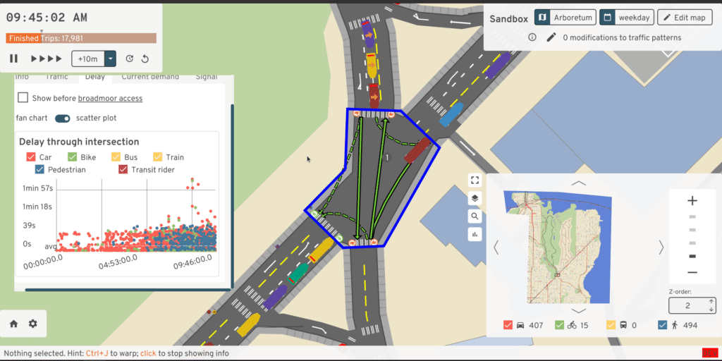
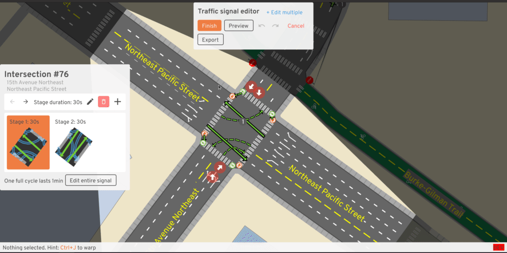
You can also change how traffic signals work. You can modify the timing if you notice left turns need more time, or set up actuated timing, so that the green light lasts longer when many vehicles are waiting. You can also change which movements are allowed each stage, so you could try out a dedicated left turn stage or a pedestrian all-walk/scramble cycle.
Measure
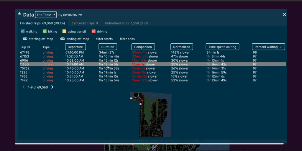
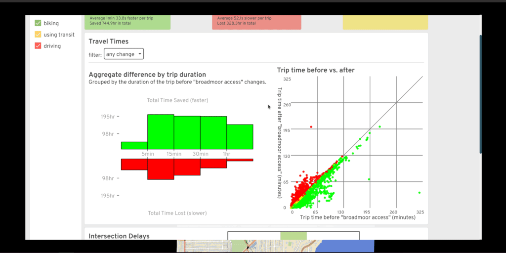
A/B Street lets you tell data-driven stories about both infrastructure and people.